Prevention and Detection of
Wild & Forest Fires
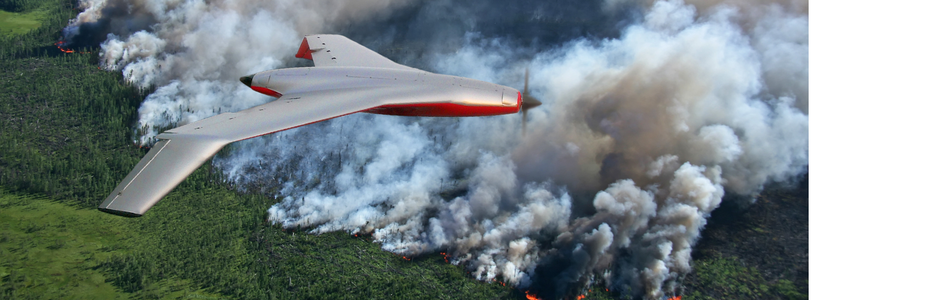
SI offers different systems for the Detection and Prevention of Wild & Forest Fires and the Support of Fire Fighting Forces. Using LIDAR, Multispectral and Infrared Cameras the Biomass can be measured that acts as the fuel for fire and the likelihood of a fire burst be predicted. By patrolling regularly over endangered areas the most critical locations can be identified for more detailed investigations and surveys. Using Real-time 2D Mapping software maps of the Temperature distribution, Moisture and Biomass are created. By overlaying maps of consecutive mission flights critical environmental changes are identified.
Using high-end cameras like MX-8 / MX-10 along with portable tracker systems for fire fighters as well as automatic person Detection &Tracking software like KESTREL are the key features for life saving missions.
Recommended UniversalUAV mission-equipment for this purpose consists of the following main components:
UAV-Sensorics:
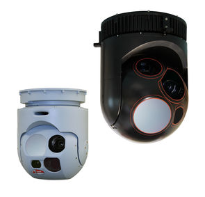
Wescam MX-8 / MX-10
- Military Grade
- Daylight camera
- Infrared camera
- Laser range finder…
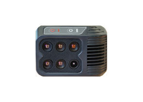
LIDAR System
- Operating Flight Altitude 900 m
- 330° FoV
Multi-Spectral Camera
- 6 Synchronized global shutter sensors
- 1280 x 960 pixels (.tiff, 12 bit)
- Up to 2 images/second
- Configurable bands (450-950nm)
- Field of view configurable (25° to 60°)
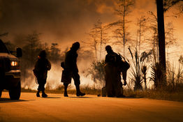
Firefighter Personnel Tracking
- Real time GPS position of Firefighters
- Tracker Device with Emergency Alert and Man-Down function
- Situational Awareness: GPS position of Firefighters shown in Mission Software
- 45 km max. slant range between Firefighter position and UniversalUAV acting as relays station
Generic Ground Station S/W:
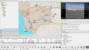
AIMS-ISR – Automated Fire Detection and Prediction
Exploration & Correlation Analysis of critical conditions like extreme temperature and prolonged drought
- Small object detection
- Moving object tracking
- Real-time and Forensic Operation
- Geo-location Data